Build your first location
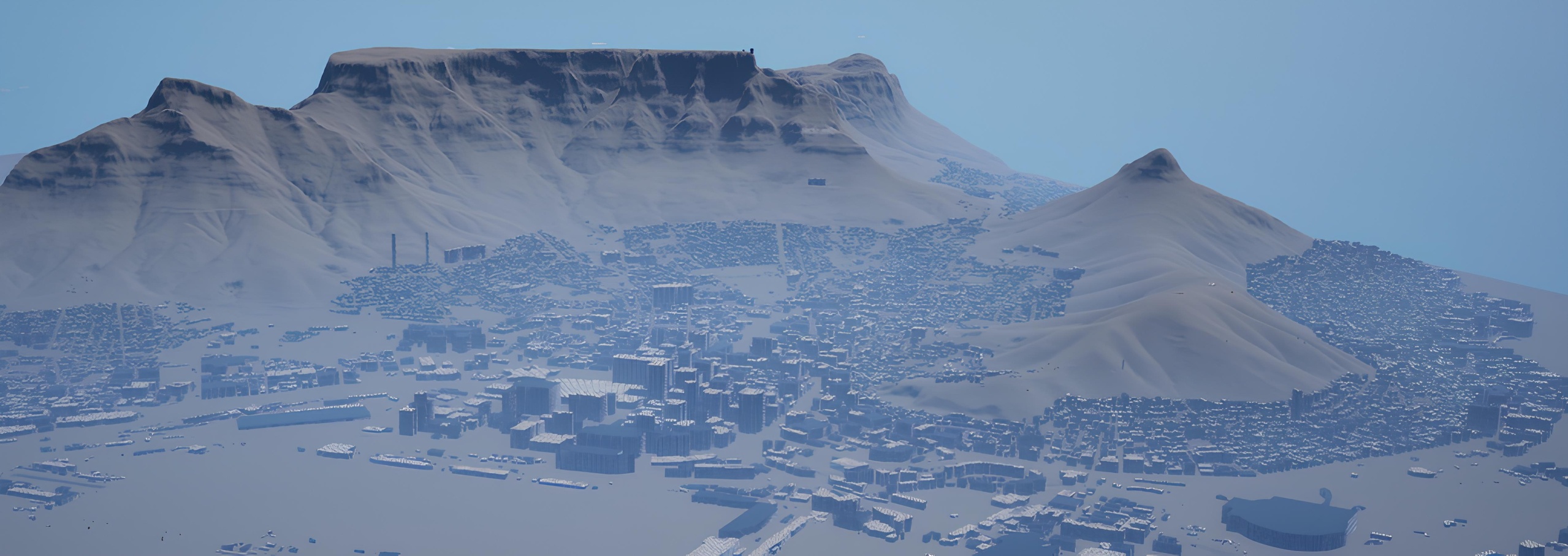
GeoScape fetches OpenStreetMap buildings & roads and global elevation for a bounding box, then generates a to-scale Landscape with Nanite buildings and roads. From install to a built city in a few minutes.
Requirements
- Unreal Engine 5.8, with the Geometry Scripting plugin (enabled automatically as a dependency).
- Windows (Win64). Source builds require a C++-capable project and the Unreal Engine 5.8 Visual Studio toolchain.
- Internet access at author time (for the fetch). Offline? Use the bring-your-own-GeoJSON path with a local elevation source.
Install & enable
Get GeoScape from Fab
Purchase GeoScape on Fab with your Epic account. In the Epic Games Launcher, open Unreal Engine → Library → Fab Library, find GeoScape and install it for your supported engine version. Use the same Epic account as your purchase.
Enable the plugin
Open your project, go to Edit → Plugins → GeoScape, enable it and restart the editor. Geometry Scripting is enabled as a dependency.
YourProject/Plugins/GeoScape/, regenerate Visual Studio project files from the .uproject, then build the Development Editor target before enabling it. Keep a single installed copy of GeoScape to avoid duplicate plugin errors.Build a location
Open a fresh empty level
File → New Level → Empty Level. GeoScape drapes geometry onto the terrain with downward traces, so it needs the Landscape resident, a non–World-Partition level is ideal for the build pass.
Open the GeoScape panel
Tools → GeoScape — Real-World City Builder (or Window → GeoScape).
Enter a location
Set Center Latitude / Longitude (grab them by right-clicking a spot in Google Maps), an Area Size (km), and Terrain Detail. Tick the layers you want: Terrain, Buildings, Roads.
Press Build Location
The progress bar reports each stage. When it finishes, the terrain and city are in your level. Clear removes everything a build generated.
Settings
| Setting | Meaning |
|---|---|
| Center Latitude / Longitude | WGS84 point the area is centered on (e.g. -33.9249, 18.4241). |
| Area Size (km) | Side length of the square region. Grows the landscape and fetch time. |
| Terrain Detail (m/vertex) | Landscape vertex spacing. Smaller = finer terrain, larger landscape. |
| Terrain / Buildings / Roads | Which layers to generate. Any combination. |
Blueprint & Python API
Everything the panel does is on the GeoScapeSubsystem editor subsystem.
import unreal
sub = unreal.get_editor_subsystem(unreal.GeoScapeSubsystem)
# latitude, longitude, area_km, terrain_detail_m, terrain, buildings, roads
sub.build_location(-33.9249, 18.4241, 1.0, 4.0, True, True, True)
sub.is_busy()                    # True while a build runs (one at a time)
sub.clear_generated("GeoScape")  # remove generated actors, returns count
// C++
UGeoScapeSubsystem* Sub = GEditor->GetEditorSubsystem<UGeoScapeSubsystem>();
Sub->BuildLocation(40.7128, -74.0060, 2.0); // Manhattan, 2 kmThe build is asynchronous (HTTP fetch) and completes on the game thread, so actors spawn safely. Progress and results are written to the Output Log with a [GeoScape] prefix.
Data sources & bring your own
GeoScape ships pointed at the public OpenStreetMap Overpass API and a global terrain-RGB elevation source. Both are configurable on the build request, so you can use a private mirror or a commercial provider for production and bulk work.
It also parses your own data: a generic GeoJSON FeatureCollection (Polygon/MultiPolygon buildings, LineString/MultiLineString roads) and Overpass JSON. A configurable field mapping tells GeoScape which properties carry height, storeys, width, and lanes, so any provider's schema resolves correctly.
World Partition & HLODs
For large areas, build into a normal level, then run the standard WorldPartitionConvertCommandlet and WorldPartitionHLODsBuilder. Keep the Landscape always-loaded (Is Spatially Loaded = false) so distant terrain stays visible for establishing shots while buildings and roads stream by cell. Nanite handles building/road LOD automatically.
Troubleshooting & support
- No buildings: try a denser city center and inspect the Output Log for
[GeoScape]messages. Public Overpass servers can be busy or rate-limited; allow time or configure a mirror. - Buildings float or sink: generate terrain with the city, or ensure an existing Landscape is loaded before building. Start in a normal empty level.
- Blocky terrain: lower Terrain Detail (m/vertex). Finer geometry cannot add detail missing from the elevation source.
- Plugin missing after purchase: check the Epic account and selected engine version in the Launcher, then refresh your Fab Library.
Need help? Email [email protected] with your engine version, plugin version, coordinates, area size and relevant Output Log messages.
Data licensing
GeoScape is purchased and licensed through Fab. The map data it downloads carries separate source terms:
- OpenStreetMap buildings & roads — © OpenStreetMap contributors, under the Open Database License (ODbL). Review the source terms for attribution and any share-alike obligations before distributing generated content.
- Elevation — the AWS Terrain Tiles open dataset (public-domain sources, aggregated). Attribution varies by region.
Respect each service's usage policy and rate limits, the public Overpass API is shared. GeoScape does not redistribute map data; it fetches it at author time to your machine.